RECENTLY VIEWED
Skip to main content

DK Hardware Professional Tax Exempt? Net 30? - DK Net Terms
Roll over image to zoom in
Product Features
Product Overview
Related Videos
Reviews
Questions & Answers
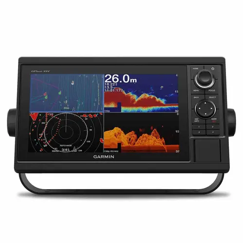
Garmin International 010-01740-00 GPSMAP 1022 Multifunction Display with Worldwide Basemap Charts Color
Item #: 010-01740-00 by Garmin International
Brand: Garmin International
UPC #: 753759168308
See reviewsSee reviews
30 Days Easy Return. We are the largest supplier of the most adaptable, personalized hardware in the industry. We work hard to ensure you're satisfied with our products.
WARNING: This Product May Contain Chemicals Known to the State of California to Cause Cancer or Reproductive Harm. To Learn More Visit P65Warnings.ca.gov
Features
Voltage
12 Volts DC
Dimensions
12.5" x 7.3" x 2.7"
Type
Chartplotter
Warranty
Two years
Card Type
Micro SD
Waterproof
IPX7 Waterproof
Antenna
Internal GPS Antenna
Mount Type
Flush , Bracket
Display Color
Color
Best Use
Cruising , Fishing , Sailing
Cartography
Worldwide Basemap
Diagonal Screen Size
10"
Display Shape
Horizontal
Product Overview
10 inch Chartplotter Is All-in-1 Solution GPSMAP 1022 is designed for cruisers, sailors and sailing racers who need the advanced all-in-1 solution provided by our 10 inch keyed chartplotter. Features a large, bright screen coupled with a quick and easy-to-use keypad interface with user-programmable keys and a multifunction control knob. Complete Network Sharing Garmin Marine Network support allows sharing of sonar, maps, user data, dome or open-array radar, IP cameras and Panoptix sonar among multiple units. Includes NMEA 2000 network connectivity and NMEA 0183 support for autopilots, digital switching, weather, FUSION-Link, VHF, AIS and other sensors. Built-in Wi-Fi and ANT Connectivity You also enjoy built-in Wi-Fi and ANT wireless connectivity directly to quatix marine watches, Garmin Nautix in-view display, gWind Wireless 2 transducer, GNX Wind marine instrument and wireless remote controls. You can even stream and control a VIRB action camera from the chartplotter. Heading, Position Refreshed 10 Times per Second Fast, responsive built-in 10 Hz GPS and GLONASS receiver refreshes your position and heading 10 times each second to make your movement on the screen more fluid. It makes dropping up to 5,000 accurate waypoints and finding your way back to them quick and easy. Upgrade to Our Best Maps on the Water Two SD card slots provide expandable memory for accessory map purchases, such as LakeV HD, LakeV HD Ultra, BlueChart g2 HD or BlueChart g2 Vision HD, which adds Garmin patented Auto Guidance 1; and other great features. Built-in SailAssist Features To help you gain a wind-maximizing competitive edge, your chartplotter features a pre-race guidance page that shows your virtual starting line along with data fields showing laylines, time to burn before the start and a race timer that can be synchronized across all your networked Garmin GPS products. In addition, other supported sailing features include an enhanced wind rose, heading and course-over-ground lines, set and drift, true and apparent wind data and more. GPX Waypoints Transfer If you have waypoints, tracks or frequently used routes stored on another manufacturer's GPS product or on a Garmin handheld device it's easy to transfer those items to your new Garmin chartplotter via industry-standard GPX software formatting.