RECENTLY VIEWED
Skip to main content

DK Hardware Professional Tax Exempt? Net 30? - DK Net Terms
Roll over image to zoom in
Product Features
Product Overview
Related Videos
Reviews
Questions & Answers
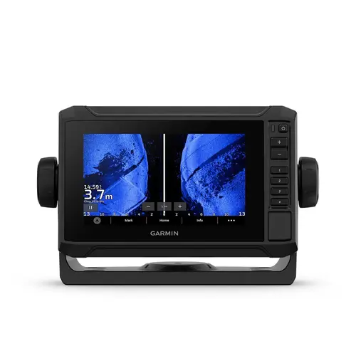
Garmin International 010-02681-00 ECHOMAP UHD2 64sv Fishfinder/Chartplotter Combo with Navionics+ US Coastal and Great Lakes Charts, No Transducer Color
Item #: 010-02681-00 by Garmin International
Brand: Garmin International
See reviewsSee reviews
30 Days Easy Return. We are the largest supplier of the most adaptable, personalized hardware in the industry. We work hard to ensure you're satisfied with our products.
WARNING: This Product May Contain Chemicals Known to the State of California to Cause Cancer or Reproductive Harm. To Learn More Visit P65Warnings.ca.gov
Features
Transducer Included
Not Included
Sonar
Down Imaging, Side Imaging, Traditional, Temperature
Display Shape
Horizontal
Diagonal Screen Size
6 Inches
Cartography
Navionics+ US Coastal and Great Lakes
Display Color
Color
Mount Type
Flush, Quick Disconnect, Tilt
Waterproof
Waterproof
Warranty
Two years
Type
Plotter-Finder Combo
Dimensions
8.1" x 5.2" x 2.6"
Product Overview
The 6" ECHOMAP UHD2 touchscreen with keyed-assist chartplotter knows the water better than a local. See clear, sharp fish arches with Garmin traditional sonar. ClearV and SideV scanning sonars feature vivid color palettes for clear, high-contrast views all around your boat (transducer sold separately). ECHOMAP UHD2 also supports LiveScope sonar systems. Navigate the waters with built-in Garmin Navionics+ cartography. Built-in Wi-Fi connectivity lets you wirelessly share sonar, waypoints and routes with another ECHOMAP UHD2 chartplotter. Wherever you drop your line, get improved position accuracy, particularly in areas where signals are reflected or weak, with multi-band GPS. You can also pair with the free all-in-one ActiveCaptain app on your compatible smartphone for access to the OneChart feature, software updates and more. The chartplotter supports NMEA 2000 networks to connect your compatible autopilots, digital switching, music, and more to view all on one screen. Features: Sonar Support With crisp, clear traditional sonar and brilliant ClearV and SideV scanning sonars, the fish will have nowhere to hide. Your ECHOMAP UHD2 also supports LiveScope live-scanning sonar. Vivid Color Palettes High-contrast vivid scanning sonar color palettes make it easier than ever to distinguish targets and structure. Bundle Your Transducer Your ECHOMAP UHD2 device supports a variety of Garmin transducers. The 6" and 7" chartplotters come bundled with a GT54 transducer while the 9" chartplotter comes with a GT56 transducer. Preloaded Charts You ve never seen Garmin cartography like this before. Select chartplotters come with built-in Garmin Navionics+ cartography which includes a 1-year subscription for daily updates, depth range shading and more. Wireless Networking If you have another compatible ECHOMAP UHD2 chartplotter on your boat, you can wirelessly share information such as sonar (LiveScope sonar cannot be shared wirelessly between two ECHOMAP UHD2 chartplotters), waypoints and routes with them. ActiveCaptain App Built-in Wi-Fi connectivity pairs with the free all-in-one mobile app on your compatible smartphone for access to the OneChart feature, smart notifications, software updates, Garmin Quickdraw Community data and more (Requires the ActiveCaptain app on your compatible smartphone paired to the ECHOMAP UHD2 6", 7" and 9" chartplotters). Auto Guidance+ Technology Chartplotters with built-in Garmin Navionics+ charts include downloadable Auto Guidance+ technology3 with the ActiveCaptain app (Auto Guidance+ is for planning purposes only and does not replace safe navigation operations). Troll with FORCE Your ECHOMAP UHD2 wirelessly connects to your Force trolling motor to create and follow routes, navigate to waypoints, control speed, check battery life and more. Power-Pole Shallow Water Anchor By networking select Garmin chartplotters with a Force trolling motor and your compatible Power-Pole shallow water anchoring system, you can access advanced boat control features (Integration of these features requires purchase of a C-Monster GATEWAY through Power-Pole) from your plotter, including smart anchor auto-deployment, smart anchor jog, auto stow, anchor drag detection and auto guidance (Auto guidance is for planning purposes only and does not replace safe navigation operations) end-of-route anchoring. Spend more time fishing, less time positioning. Charge Integration from Power-Pole Your CHARGE Marine Power Manager from Power-Pole integrates with compatible Garmin chartplotters to help keep your battery power going longer and stronger on the water. You re able to charge batteries on the run, monitor power use, select where power is allocated, control emergency starts and even transfer power between battery banks all from your chartplotter display. Multi-Band GPS Get improved position accuracy, particularly in areas where signals are reflected or weak, with multi-band GPS. In the Box: