RECENTLY VIEWED
Skip to main content

DK Hardware Professional Tax Exempt? Net 30? - DK Net Terms
Roll over image to zoom in
Product Features
Product Overview
Related Videos
Reviews
Questions & Answers
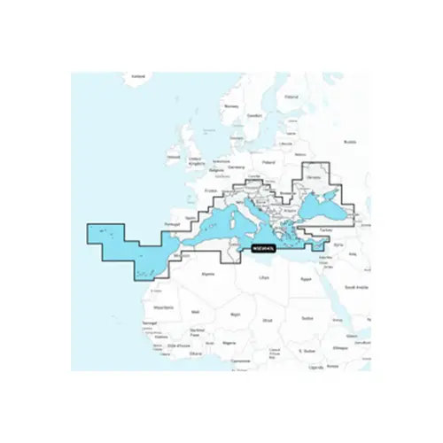
Garmin International 010-C1351-40 Navionics Platinum+ EU643L Mediterranean and Black Sea, Electronic Chart
Item #: 010-C1351-40 by Garmin International
Brand: Garmin International
See reviewsSee reviews
30 Days Easy Return. We are the largest supplier of the most adaptable, personalized hardware in the industry. We work hard to ensure you're satisfied with our products.
WARNING: This Product May Contain Chemicals Known to the State of California to Cause Cancer or Reproductive Harm. To Learn More Visit P65Warnings.ca.gov
Features
Type
Electronic Charts
Card Type
Navionics Platinum+
Cartography
Europe
Product Overview
Detailed coverage of the Mediterranean and Black Seas. Coverage includes the Azores, Madeira, the Canary Islands, Gibraltar, the Balearic Islands, Corsica, Sardinia, Sicily, Malta, Crete, Cyprus, the Dardanelles, the Bosporos, the Sea of Azov, the Dneiper River to the Kyivs'ke Reservoir, the Danube River to Passau, Germany, Lake Balaton, Lake Garda, Lake Como and Lake Maggiore. Ports include Cadiz and Barcelona, Spain; Monaco; Marseille and Toulon, France; Genoa, Naples, Taranto and Venice, Italy; Istanbul, Turkey; Odessa, Ukraine; Tunis, Tunisia and Algiers, Algeria. Features: