RECENTLY VIEWED
Skip to main content

DK Hardware Professional Tax Exempt? Net 30? - DK Net Terms
Roll over image to zoom in
Product Features
Product Overview
Related Videos
Reviews
Questions & Answers
WATERPROOF CHARTS 22F Tampa Bay Area Inshore Fishing
Item #: 22F by WATERPROOF CHARTS
Brand: WATERPROOF CHARTS
See reviewsSee reviews
30 Days Easy Return. We are the largest supplier of the most adaptable, personalized hardware in the industry. We work hard to ensure you're satisfied with our products.
WARNING: This Product May Contain Chemicals Known to the State of California to Cause Cancer or Reproductive Harm. To Learn More Visit P65Warnings.ca.gov
Features
Region
Gulf Coast
Features
Double Sided , Fishing , Waterproof
Cartography
Tampa Bay (Inshore , Fishing)
States
Florida
Product Overview
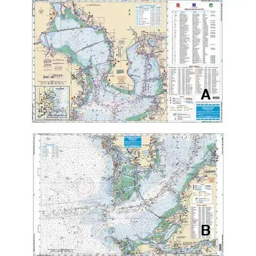
Covers the area from the ship channel inshore, coastal coverage from Treasure Island to Anna Maria, up the Manatee River to the I-75 bridge, and the entire Tampa and Old Tampa Bays to Safety Harbor. This special chart details all the major grass flat areas and pinpoints dozens of specific areas for the major species caught in the area: cobia, mackeral, snook, grouper, redfish, tarpon and trout. In addition, there are 64 listings, plotted and indexed for reefs, wrecks, and fish-holding structure with high accuracy GPS positions and major target species combined with a separate GPS table for navigational aids to help you set up your GPS. A handy marine facilities guide gives detailed information on 50 different boat ramps, marinas, and bait and tackle stores all shown on the chart. If you're fishing the Tampa Bay area, this is the one chart to have! Information from 2 NOAA charts: #11415 and #11416. GPS datum.